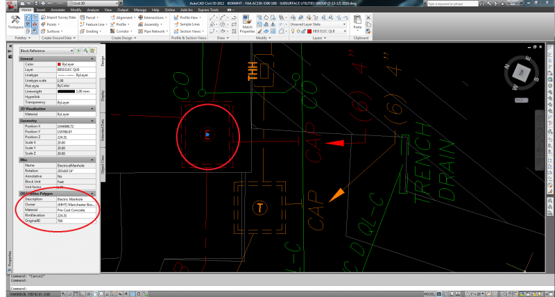
Facility owners and Municipalities throughout the world have come to realize the power of GIS data management. Instead of a simple AutoCAD or Microstation electronic file, imagine that you could possess an interactive geo database that can store multiple levels of information in regards to utilities both above and below grade. Information such as age, condition, date installed, last replaced, wire type, pair count, etc. Even sewer/drain flow directions, inverts, and underground manholes/vaults can have survey data input in a manor that makes information queries simple and fast.
The use of Graphical Information Systems (GIS) will be the way of the future for all civil and environmental engineering disciplines. BSI realizes the importance of such systems and as a result we have incorporated GIS capabilities into our SUE and Civil engineering services for clients wanting only the most state-of-the-art data management capabilities. Please contact one of our experienced Project Managers to see if GIS Data Management is the right choice for your facility.